BASE CAMP
Escape The Ordinary
Established in 1984, in Viareggio, Italy, Navionics® produces electronic charts for the leisure boating market.
Their mission is to delight customers by producing market leading intuitive and innovative marine cartography content and features through the use of creativity, engineering excellence through market knowledge and efficient production procedures.
Navionics were born from a revolutionary idea: the world's first electronic chart display, or chartplotter.
We use location services every day on our mobile devices, and maybe even take them for granted. But, think about it: how pioneering is that?
This state of mind is what Navionics® is founded on and their focus for future goals.
Go Fishing with Navionics
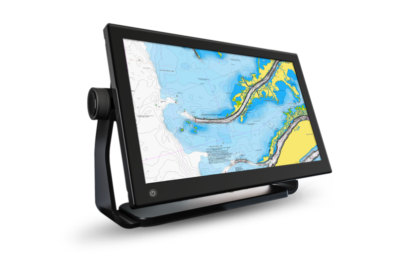
SonarChart™

SonarChart, our 1'ft contoured chart layer, gives you a detailed view of shallow waters, ledges, humps and more. Discover the "Top Five Reasons" to use SonarChart in this video by our ProStaffer
Fish Attractors
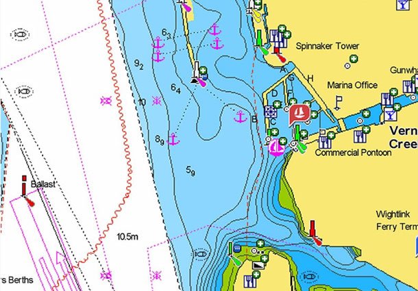
Fish seek out particular types of habitats where they prefer to nest. In many lakes and coastal waters, angling clubs and fisheries organizations will sink structures to attract fish and encourage a healthy fishery. Navionics charts include more than 10,000 fish attractors.
SonarChartTM Live
With SonarChart Live, you can count on the most up-to-date information because the bathymetry is drawn on the screen of your device in real time. When you create your own maps, you can feel confident that you're making decisions based on the most recent depth data. Watch the video
If Fishing Is Your Passion
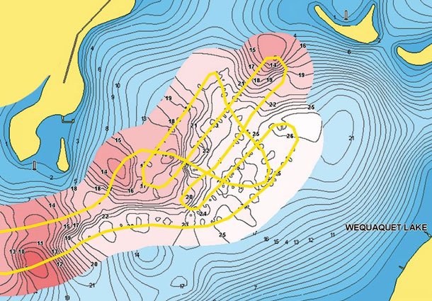
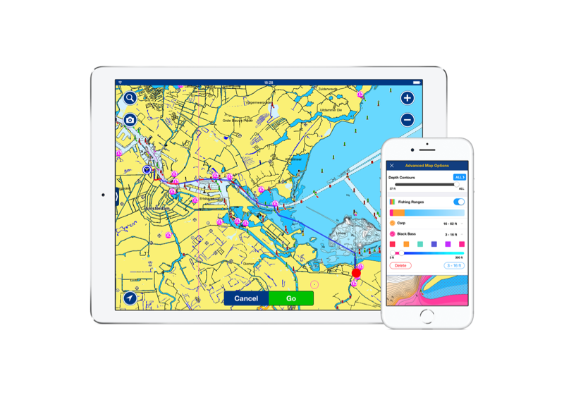
Fishing Ranges
Fishing Ranges will help you interpret the structure, identify patterns and focus on where to cast. Watch the video
Advanced Map Options
Customize your view of Navionics charts to highlight shallow areas, adjust SonarChart™ contour density, and target a fishing range!
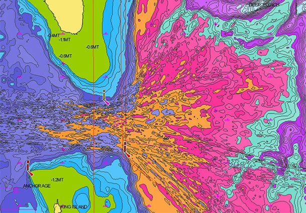
SonarChart Shading
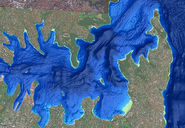
A detailed rendering of the seafloor and lake bottoms in varying shades of blue offers anglers clear visual cues to identify fish-holding structure at a glance. Watch this video
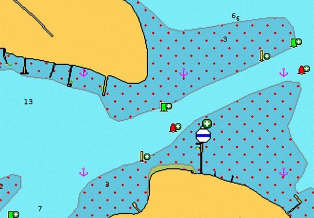
The Navionics Family of Products
NAVIONICS +
Inshore to offshore marine content plus rivers, bays and more than 40,000 lakes around the world.
PLATINUM
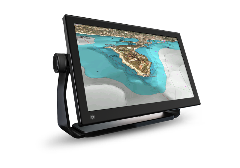
All the content of Navionics+, enhanced with SonarChart Shading, 3D View and Panoramic Photos.
BOATING APP
The same detailed charts and advanced features used on the best GPS plotters.